

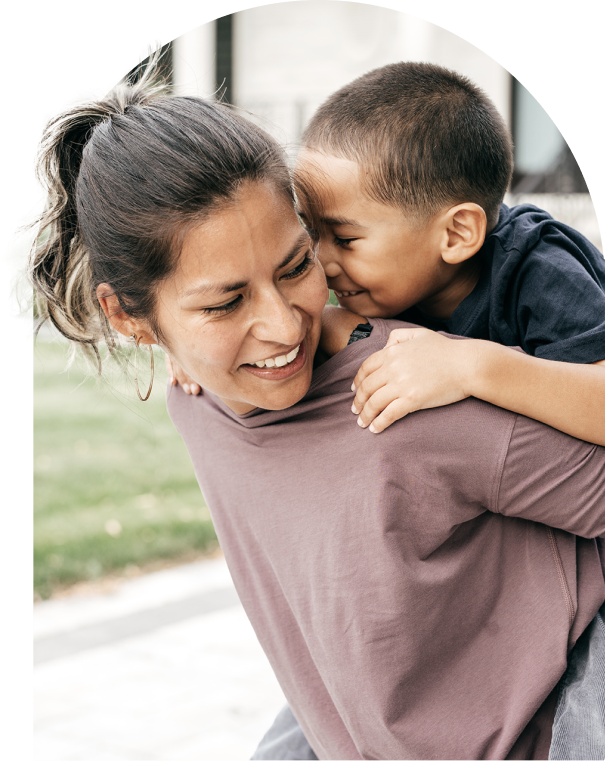
Ways to Give
Join one of the largest donor networks in the region to maximize your charitable giving impact today and into the future.
Menu


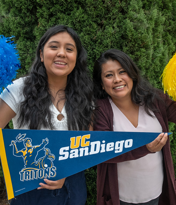


Explore the programs that do good for the San Diegans who need it most.
Join one of the largest donor networks in the region to maximize your charitable giving impact today and into the future.


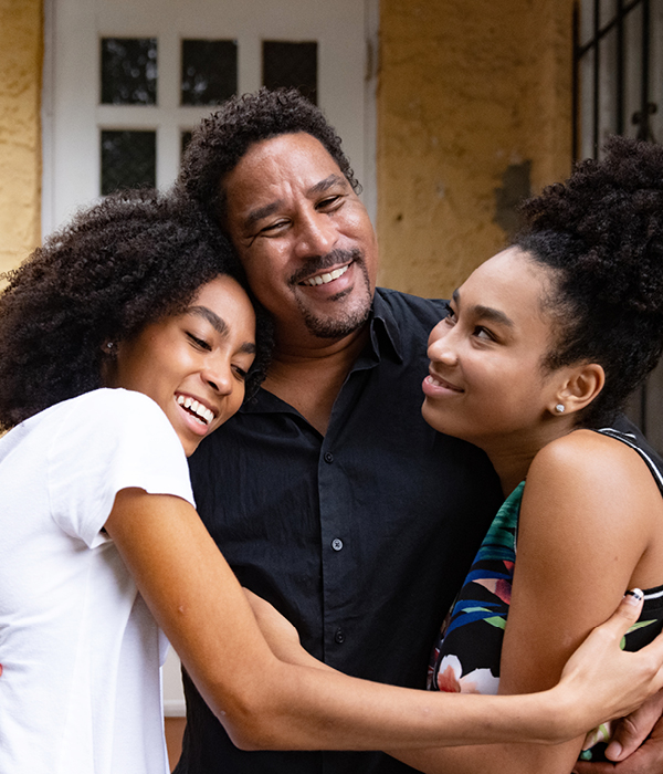
Everyone who calls San Diego County home should have the opportunity to prosper, thrive, and feel like they belong.

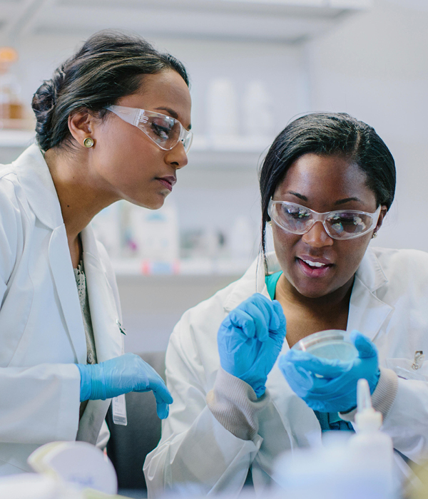
Grant Announcement
$838K in Grants to Local Nonprofits to Create More Inclusive, Equitable and Accessible Outdoor Experiences
On August 9, 2022, we awarded $838,704 in Opening the Outdoors grants to 24 nonprofit organizations that offer equitable access to outdoor spaces in San Diego County.
“San Diego Foundation is proud to once again support its partners committed to increasing community-driven efforts to enhance accessible outdoor space, encourage youth to learn more through hands-on education and create the next generation of environmental stewards in the San Diego region,” said Christiana DeBenedict, SDF Director of Environment Initiatives.
This year’s grantees will help address these inequities and enhance access to the outdoors throughout San Diego County.
About Kim Klein
Kim Klein is internationally known as a consultant, trainer and facilitator. She has been in fundraising for over four decades and has presented workshops in all 50 states and 25 foreign countries. She has a certificate in Spiritual Direction and believes the role of nonprofits is to, in the words of Peter Maurin, “create a world in which it is easy to be good.”
She has just completed the 8th edition of her classic book, Fundraising for Social Change. This edition is co-authored with Stan Yogi and amplifies examples of organizations and social movements which have demonstrated how raising money from individuals gives organizations maximum power and autonomy.
She recently retired from teaching at the School of Social Welfare at UC Berkeley and lives in Berkeley with her wife and two cats.
About Karen E. Osborne
Karen believes in the power of philanthropy, generosity, and service. She built her career around these passions not only as a major and principal gifts officer, vice president, speaker, teacher, consultant, and coach, but also as a donor, volunteer, and board member.
For eighteen of Karen’s forty-five professional years, she held leadership positions–Director of Major Gifts, Director of Development, and VP for College Advancement–at colleges and universities. For the past 27 years, Karen served first as President and now Senior Strategist at The Osborne Group, an international management, consulting, and training firm.
Karen enjoys a rich volunteer life. The Council for the Advancement and Support of Education (CASE) awarded her the Crystal Apple for Outstanding Teaching and Public Speaking, and the Ashmore Award for Outstanding Service to the Profession. In addition to volunteering for professional organizations, she serves as chair of the governing board of Easterseals Florida and volunteers in her community and church.
Karen is also a suspense, historical, and mystery writer. Getting It Right, June 2017. Award-winning and best-selling Tangled Lies, July 2021. Award-winning Reckonings, June 2022. Award-winning, historical, suspense, True Grace released September 2023. Her weekly Vlog, three-years old, What Are You Reading? What Are You Writing? showcases authors and other creatives.
About Mark A. Stuart, CFRE
A fundraising and community-building professional for nearly 30 years, Mark Stuart has devoted his career to helping donors realize their hopes, dreams and aspirations.
Since joining San Diego Foundation as President and CEO in May 2019, SDF has grown its assets to $1.5 billion. Under Mark’s leadership, SDF raised and deployed $67 million for COVID-19 relief efforts and in its most recent fiscal year granted a record $150 million.
During Mark’s tenure, SDF has launched a new strategic plan and vision for just, equitable and resilient communities, and has been named a Top Work Place by The San Diego Union-Tribune four years running.
Before joining SDF, Mark managed a staff of 64 and a budget of $14 million at San Diego Zoo Global (SDZG). He led SDZG’s first-ever comprehensive fundraising campaign, raising $530 million.
Mark serves on the Board of Directors for Certified Fundraising Executives International, the League of California Community Foundations, San Diego Regional Policy and Innovation Center and San Diego Symphony Foundation.
Opening Session
Speaker: Mark A. Stuart, CFRE, President & CEO, San Diego Foundation
San Diego Foundation President & CEO Mark A. Stuart will welcome attendees to the first-ever San Diego Fundraising Conference and share what’s in store for the day ahead.
Moving Your Fundraising Forward in 2023 and ’24
Speaker: Gail Perry, Founder & President, Gail Perry Group
Let’s look at trends and predictions for fundraising in 2023 and ’24. The giving environment continues to change – and donors are changing as well.
We’ll review the strategies you need to focus on this year, what’s working – and what’s not working in fundraising today. Where are the opportunities? How do we appeal to today’s donors? What are they looking for, and what will make them respond?
Join us to take a ride through the events and issues on the philanthropic landscape both now and in the near future.
The Conversational Ask: An Easier Way to Raise Money from Happy Donors
Speaker: Gail Perry, Founder & President, Gail Perry Group
You have major gift prospects, but do you know how to bring up the idea of a potential gift? Don’t get stuck in endless cultivation – here’s how to move right into a Gift Conversation.
Gail will show you the path that will lead a donor from Discovery directly to an Ask Conversation. You’ll learn how to read your donor’s signals, and how to politely put an Ask on the table.
We’ll have some fun learning Power Discovery Questions that can light up your donor’s heart. You’ll have a chance to actually practice them, and you’ll see for yourself how they can unlock a donor’s enthusiasm and generosity.
Even more, You’ll discover how asking permission keeps your donor engaged and comfortable. These conversation-based asking and closing techniques will help you close more mega gifts!
Fundraising Wisdom Project
Speaker Panel
Wisdom is more than the accumulation of wins and losses. It is found at the intersection of knowledge, good judgment, and experience.
The goal of the Fundraising Wisdom Project is simple: we asked talented fundraising leaders to consider what wisdom they might share with their much younger selves. What guidance would they want to provide to those who might be newer to our profession to put those careers on a brighter and better trajectory?
Come to the conference’s closing session to hear five-minute (or less) stories from our presenters and other wise leaders, who have more than 200 years of collected wisdom, to inspire and enhance your impact on the San Diego region.
About Karen Boyd, Ph.D.
Karen Boyd, Ph.D. is an economist and the Director of Research at the San Diego Regional Policy and Innovation Center. In this role, she is responsible for developing, executing, and sharing actionable, equity-focused research on the region’s most pressing economic, social, and environmental problems.
She has published and presented research on artificial intelligence and the future of work in a variety of top-tier academic venues and was an editor for JASIST’s Special Issue on “Artificial Intelligence and Work.”
Karen earned her Ph.D. from the University of Maryland, College Park (2020), where she studied ethics in the curation of training data for machine learning models. She completed a postdoctoral fellowship at the University of Michigan School of Information, studying the ethical implications of automated emotion recognition algorithms designed for use in the workplace. She also has an MBA from the Rady School of Management at the University of California, San Diego (2011) and a bachelor’s degree from San Diego State University.
About Cassie Carter, Ph.D.
Cassie Carter, Ph.D. is Vice President and West Region Director at Campbell & Company. She brings 30 years of passion for nonprofits, focusing on strategic and fundraising planning that builds a shared understanding of mission, leveraging strengths of organizations to achieve long-term success.
Prior coming to Campbell eight years ago, Cassie was Associate Vice President for Development and Director of Campaigns at Hawaii Pacific University, Associate Vice President for Development Operations Cal Poly, San Luis Obispo, and Executive Director of the Montana Outdoor Science School.
Currently she serves at the Co-President for the Association of Fundraising Professionals – Greater Los Angeles Chapter, as board chair for the Foundation for Pierce College, and is a member of the faculty for the Center for Nonprofit Leadership at Cal Lutheran.
Cassie has a doctoral degree in Teaching and Learning with an emphasis in public administration from the University of Southern California, and a bachelor’s in biology from California State University, Northridge.
About Kirsten Farrell
Kirsten Farrell is the Director of The Goodman Center, which teaches communications and marketing professionals how to reach more people with more impact. She is publishes the monthly newsletter free-range thinking and The Do Good Better Blog both of which are Goodman Center resources that share tools and guidance for public interest professionals to connect to and communicate with their audience.
The Goodman Center is internationally known for speeches and workshops on storytelling. Kirsten has facilitated innumerable workshops and webinars for clients including The Robert Wood Johnson Foundation, UCLA, The National Museum of African American History and Culture, Bank of America, NOAA, Pew Charitable Trusts and many others.
She served on the advisory team for The Corporation for Supportive Housing’s Speak Up! Program LA, where leaders with lived experience of homelessness train to tell their stories and advocate for permanent supportive housing. In her spare time, she performs as a company member of the nationally recognized Impro Theatre doing long-form narrative improv.
For more information about our work, please visit www.thegoodmancenter.com.
About Danny Kim, Ph.D.
Dr. Danny Kim catalyzes individuals and organizations to perform at their best. Danny is a skilled facilitator who creates psychologically safe environments for individual thinking and group collaboration. Using the power of inquiry, he asks insightful questions at pivotal moments to help leaders gain clarity and take courageous action. As a coach, he supports leaders when the stakes are high and decisions are complex. As a storyteller and keynote speaker, Danny inspires movement and momentum.
Danny’s career in organizational development began in the non-profit sector providing leadership in the areas of recruitment, retention, and employee development for organization effectiveness. As a career coach he conducted over 400 coaching conversations in career exploration and strengths-based leadership. During his time at the university, he began a doctoral program in Industrial/Organizational Psychology. Danny gained experience as an external consultant at an organizational consulting firm serving clients ranging from start-ups to Fortune 500 companies.
Danny is currently the Sr. Director of People, Culture and Diversity at San Diego Foundation. He holds a B.S. in Biological Sciences and a Master of Divinity in Transformational Leadership. Additionally, he holds a doctorate in Industrial/Organizational Psychology is a Gallup-Certified CliftonStrengths coach and on-call faculty at the Center for Creative Leadership.
About Stephen Mally
Stephen Mally brings over three decades of fundraising and non-profit consulting experience.
Having served as a fundraiser in the United States, Stephen transitioned to consulting in Asia-Pacific, Europe, and North America in 2008. He is the CEO and Director of FundraisingForce, a boutique consulting firm based in Sydney, Australia and Rancho Mirage, CA. As a consultant, he has worked with thousands of schools, universities, and charities gaining a vast amount of exposure to diverse organizations and fundraising programs. Stephen acquired his Certified Fundraising Executive (CFRE) credential in 2011.
Stephen was named a Fellow of the Fundraising Institute Australia (FIA) in 2017. He served on the FIA Board for six years and currently serves on the CFRE International Examination Committee and CFRE International Board as its Vice Chair. He is also on the board of Pink Elephants Support Network in Australia.
About Adrienne D. Vargas
Adrienne Vargas has more than 30 years of development experience. She started her career as a student at Fordham University where she called alumni asking for donations. She then worked in annual giving for Harvard University before becoming a development officer for Grossmont Hospital Foundation. After six years at Grossmont Hospital Foundation, Adrienne was recruited to join The San Diego Foundation, where she worked for 20 years in a variety of roles, including overseeing human resources, the volunteer program, the San Diego Women’s Foundation, and donor relations.
In 2017 Adrienne joined San Diego State University as the Associate Vice President of Development before taking on the roles Vice President for University Relations and Development and President and CEO of The Campanile Foundation in 2018. Since joining SDSU, philanthropic support for the university has increased from over $83 million in 2018 to $136 million in fiscal year 2022.
How to Build a Highly Successful Monthly Giving Program
Speaker: Harvey McKinnon, President, Harvey McKinnon Associates
Fact: The average monthly donor will give 5 – 20 times more money than a single gift donor. Your organization needs more of them.
In this seminar, Harvey McKinnon will teach you how to start and grow a lucrative monthly giving program, or improve your existing one. You’ll learn how to avoid common mistakes and maximize your income. You’ll come away with techniques to promote donor loyalty, raise more money, and increase your organization’s financial stability. Harvey will illustrate these lessons with real-life examples and case studies that you can apply to your own organization.
Harvey has been called the “Master of Monthly Giving”. He has helped thousands of organizations raise billions of dollars in monthly gifts. He is the author of three of the only four books ever written on monthly giving. The first one, Hidden Gold, launched monthly giving programs globally. And his latest is: How to Create Lifelong Donors through Monthly Giving (2022).
Securing Donor-Advised Fund (DAF) Gifts and Donors
Speaker: Bill Stanczykiewicz, Ed.D., Senior Assistant Dean for External Relations, Indiana University Lilly Family School of Philanthropy
Donor advised funds (DAFs) are one of the fastest growing vehicles for charitable giving.
Why are donors using DAFs instead of giving directly to other nonprofit organizations, and how are DAFs helping donors maximize their philanthropy? Learn from the latest data on how you can incorporate DAF donors into your fundraising strategies.
The 11 Questions Every Donor Asks
Speaker: Harvey McKinnon, President, Harvey McKinnon Associates
Your prospects and donors have needs. When you satisfy these desires, they will give you money, much more money.
For over four decades Harvey McKinnon has been looking at fundraising from a donor’s perspective. In this session he looks at the 11 questions every donor asks, and he shows you how to answer them effectively. His strategy is being used by universities, international development agencies, hospitals and other nonprofits, all over the world
In this session you’ll learn:
Creating Events with Impact
Speaker: Ingrid de Llamas, CFRE, IAP, Director of Philanthropy & External Relations, Epilepsy Foundation of San Diego County
We’ve all been part of the “rubber chicken event circuit” – those sometimes dreaded, often dull events that run together in our minds. Do you even remember why the last rubber chicken dinner you attended was held? How did it benefit the cause?
Donors today want to make an impact and they expect to see how their investments are being used to make a difference. Many nonprofits fall into the trap of holding the same event over and over each year. They spend countless dollars at hotels, have the same speakers, same video program and often forget WHY people are there.
Ingrid de Llamas will share ideas, lessons learned and the importance of re-evaluating your event program to include goals, consistent messaging and an understanding of the purpose and true cost of holding events. In this session you will learn how to create events with impact to further the mission of your organization.
Fewer than half of nonprofits have boards of directors fully engaged with fundraising. Using data from BoardSource and interviews with successful nonprofits, this session reveals six research-based findings pointing toward practical steps you can take toward 100 percent board giving and fundraising.
How to Maximize Donor Potential
Speakers: Krista Lamp, Sr. Director of Brand, Events, Communication, Classy & Elizabeth Ruikka, Sr. Director of Demand Generation, Classy
Don’t miss this opportunity to gain strategic insights and tools to increase the lifetime impact of your supporters.
Discover how to maximize the lifetime value of your supporters through various campaign types. Learn about the essential elements of an effective stewardship strategy and how an all-in-one fundraising solution can unlock valuable donor insights. Gain practical knowledge on engagement strategies such as nurturing first-time supporters into repeat donors and engaging your recurring supporters at your next fundraising event. The Classy expert team will also discuss how to identify and cultivate your next generation of peer-to-peer fundraising leaders.
About Krista Lamp
Krista Lamp is the Senior Director of Brand, Events, Communication for Classy, a GoFundMe affiliate and Public Benefit Corporation that enables nonprofits to connect supporters with the causes they care about. Classy’s giving platform provides powerful fundraising tools so nonprofits can convert and retain donors. Since 2011, Classy has helped nonprofits raise over $5 billion. Previously, Krista spent 10+ years at some of the nation’s top public relations agencies.
About Elizabeth Ruikka
Elizabeth Ruikka is the Sr. Director of Demand Generation and at Classy. She is a strategic marketing leader with a decade of expertise across digital and owned marketing channels. Passionate about staying up to date with the ever-changing digital landscape, Elizabeth enjoys advising nonprofits on how to maximize the impact of their online fundraising strategy. During her tenure at Classy, she has developed a strong understanding of the unique challenges nonprofits face and is invested in their success.
About Alyssa Celones Senturk
Alyssa Celones Senturk (or Ally) is a Filipino-American creative storyteller with a multimedia marketing and science communication background. She specializes in building communities around causes for the common good – like clean water, science, and climate resilience. She is the Communications and Outreach Director for San Diego Coastkeeper, an environmental nonprofit working to protect and restore fishable, swimmable, and drinkable waters in San Diego County.
Fostering donor loyalty is an ongoing activity. The way you engage with donors after they make a gift is as important, or perhaps even more important, than the gift itself. Keeping all levels of donors involved and inspired can be the difference between a good fundraising practice and a great one. During this session, you will learn how to make your supporters feel every bit as important as they are, as you learn effective communication strategies to showcase impact and inspire major donors to continue to provide financial support. Join our presenter, Muhi Khwaja, MPA, CFRM, to learn how you can increase donor loyalty through creative stewardship and meaningful engagement strategies.
This helpful resource provides you the information you need to better understand the impact and benefits of donor-advised funds.
"*" indicates required fields
The Advisor monthly e-newsletter provides philanthropy news and trends and financial planning strategies for advisors and their clients.
"*" indicates required fields
"*" indicates required fields
Receive quarterly email updates about our Children and Families programs and initiatives and opportunities for you to support stronger families in our region.
"*" indicates required fields
Receive quarterly email updates about our Education programs and initiatives and opportunities for you to support enhanced learning experiences and increased access to college for San Diego students.
"*" indicates required fields
Receive quarterly email updates about our Environment and Climate programs and initiatives and opportunities for you to support equitable outdoor access and climate change resiliency.
"*" indicates required fields
Receive quarterly email updates about our Racial and Social Justice programs and initiatives and opportunities for you to learn about creating equitable opportunities for all and how to support our multicultural region and its diverse population.
"*" indicates required fields
This helpful resource provides you with information about corporate philanthropy and custom corporate giving solutions for your business.
"*" indicates required fields
This helpful resource will show you how you can leave a legacy to your family, your charity or your community that complements your will and trust(s).
"*" indicates required fields
Are you interested in staying up to date on the San Diego Fundraising Conference? Subscribe today and receive email updates for current and future conferences.
This valuable resource will help you understand how to set up a legacy fund and the lasting impact planned gifts can have for you, your family and your community.
"*" indicates required fields
This 10-Step Checklist guides nonprofits through partnering with SDF to accept and realize gifts of real estate. Submit the form below to download the checklist.
"*" indicates required fields